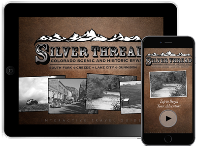


Silver Thread Scenic Byway
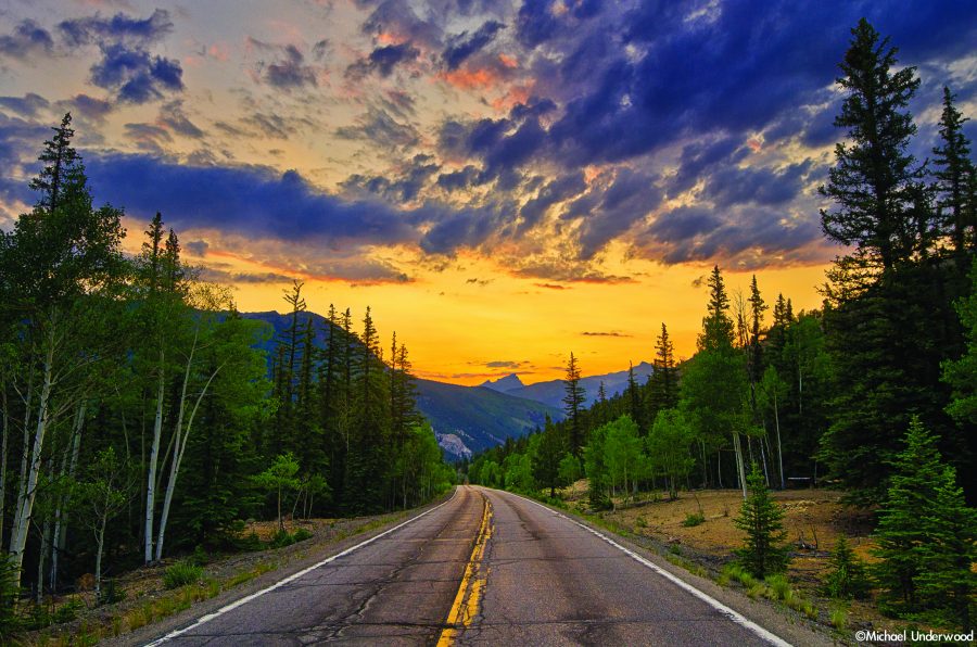
Silver Thread Scenic Byway
Like many attractions in the San Juans, the Silver Thread Scenic Byway finds its roots in the rich mining days of the late 19th century.
Industrialists and merchants became road builders and widened the narrow footpaths of the Ute Indians, turning the paths into toll roads for transporting ore, supplies, and people to the remote San Juans.
Eventually, the railroad came to Hinsdale County, making travel faster and more efficient. By the 1920s, more and more travelers were using automobiles, creating the need for better roads. Highway 149 remained a dirt road until 1968 when paving began between Lake City and Creede. The last stretch was paved in the Santa Maria Reservoir area in 1983. In 1990, portions of Highway 149 were designated as a historic byway.
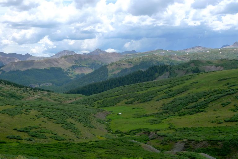
Today, the Silver Thread Scenic Byway spans the entire length of Highway 149, winding through four counties and three towns including Lake City, Creede, and South Fork. From beginning to end, it is a historical route with astounding beauty, recreational abundance, and a varied and unique geology.
Elk, deer, moose, and bighorn sheep are often seen along the highway. There are several marked stopping points along the Byway and beautiful views with every turn. For more information, pick up a Silver Thread Guide at the Lake City Visitor Center.
Points of Interest
Blue Mesa Reservoir
Located in Curecanti National Recreation Area, this 20-mile long reservoir, the largest in the state, is a popular recreation area for anglers, boaters, hikers, campers, and swimmers.
The Gate
This stunning rock formation, which resembles a gate in a fence of mountains, was carved by the Lake Fork of the Gunnison and towers over the river and highway. In this area, there is easy access to the Lake Fork and a public campground.
High Bridge
The railroad bed and trestle of a bridge owned by the Denver and Rio Grande Railroad that once spanned the canyon still remain at this site. When the line was abandoned, timbers from the bridge were removed and used to build a school in Gunnison. The road to this area is steep and may not be accessible to all cars.
Alferd Packer Massacre Site (CLOSED)
This site is no longer open to the public and the interpretive signs have been moved to the Hinsdale County Museum. Guided Alferd Packer tours will be hosted by the Hinsdale County Historical Society. In the winter of 1874, Alferd Packer led five under prepared prospectors into the wilderness. Two months later, Packer emerged alone, looking suspiciously well-fed. He later confessed to killing one crazed man in self-defense and eating the remains of his five companions in order to survive. He was eventually convicted and imprisoned until 1901. His victims are memorialized at this site.
Lake San Cristobal Overlook
A short hike is required to view Lake San Cristobal but is worth the walk. The overlook offers a view of Colorado’s second largest natural lake and surrounding peaks.
Slumgullion Earthflow
This earthflow, a National Natural Landmark, caused the damming of the Lake Fork and formed Lake San Cristobal. It continues to move up to 20 feet a year.
Windy Point Scenic Overlook
This overlook offers an unparalleled panoramic view of the northern San Juans, fourteeners, and many thirteeners.
Spring Creek Pass
The Colorado Trail and the Continental Divide Trail cross the highway at Spring Creek. This marked site includes an informational kiosk, restrooms, and a nice place for picnicking.
North Clear Creek Falls
Though it is not visible from the road, the cascade of water that appears almost magically out of a meadow at the end of this worthwhile detour will take your breath away. A short drive and walk are required to view one of the most photographed waterfalls in Colorado.
South Clear Creek Falls
Those willing to travel off the beaten path will enjoy the breathtaking beauty of two waterfalls sharing the same name. One of the South Clear Creek Falls can be reached by way of the path from Silver Thread Campground. The trail to the other falls starts from Bristol Head Campground.
Bristol Head
Named by a settler who missed his native Bristol, England, this distinctively shaped mountain is an imposing and impressive figure along the Silver Thread.
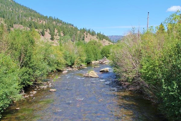
Brown Lake/Rio Grande Overlook
On the side of the Silver Thread is an overlook of impressing beauty that showcases the Rio Grande River. At this overlook, look to the skyline and locate the Rio Grande Pyramid. North of the Pyramid is the Stony Pass area, where the mighty 1,885 mile Rio Grande River begins as a little trickle of water.
Rio Grande Reservoir/Stony Pass
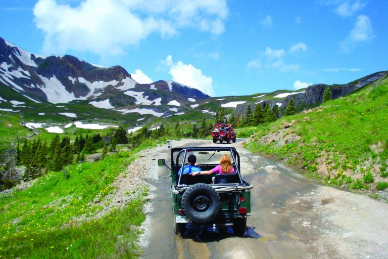
Just a few miles north of Creede is the turnoff for Rio Grande Reservoir, which is stocked with fish each summer and is open to boats. A little farther along the road is Stony Pass, a four-wheel drive only road that leads to Howardsville, an old ghost town just outside of Silverton.
Creede
During the height of Creede’s mining boom, it was said to be one of the wildest mountain towns in the west. It was home to a two-mile-long street that consisted mainly of saloons, gambling houses, and brothels. In this century, Creede is considerably tamer now. More info at www.creede.com
South Fork
This town, located at the junction of the Rio Grande River and its south fork, marks the end of the Silver Thread. It once was a highly productive timber industry town. More info at www.southfork.org.
Driving the Silver Thread
- The Silver Thread is a well- maintained, paved highway suitable for two-wheel-drive vehicles. It is open year round.
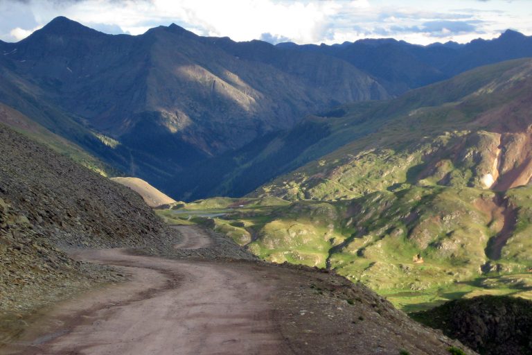
- The Byway ranges from gently rolling straight-aways to hairpin turns, and traverses two high mountain passes: Spring Creek Pass, at 10,901 feet, and Slumgullion Pass, at 11,530 feet.
- The north side of Slumgullion Pass has an incline of 9.4%, making this the steepest paved highway in the state. All drivers should use low gear when descending this pass.
- Motorcyclists should use extra caution on the Silver Thread due to loose gravel that may be on the pavement.
- Watch for deer, elk, moose, bighorn sheep, and other animals that may be in the road.
Noteworthy Area: Deer Lakes
Just north of the summit of Slumgullion Pass is Forest Service Road 788. While its official name may not sound inviting, this road is one of the greatest gateways to recreation opportunities in Hinsdale County.
This area is known for great wildlife watching, especially for spotting moose at the Upper and Lower Mill Ponds. FS Road 788 leads to 5 campgrounds, 1-day use area, access to Cannibal Plateau, numerous hiking trails, past the historic farms of Cathedral, through the Mason Family State Wildlife Area, and eventually ends in Powderhorn at Highway 149.
This road is two wheel drive and great for those looking to take the other scenic route to Gunnison. It also provides access to Los Pinos Pass, a magnificent drive, especially in the fall. High clearance is recommended for Los Pinos Pass.